Geospatial Maps
Visualize critical assets and potential threats
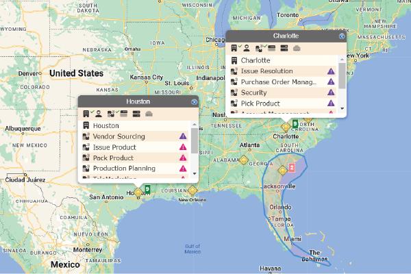
eBRP Suite’s Geospatial Maps feature offers comprehensive visualization tools for assessing and managing enterprise resiliency. By integrating advanced mapping capabilities, it enables organizations to identify and analyze the geographical footprint of assets, anticipate potential disruptions from natural or man-made threats, and make informed decisions to maintain service level agreements.

eBRP Suite’s Geospatial Maps empower organizations with comprehensive visualization tools for proactive risk management. By integrating asset views, shape overlays, and notification systems, it enhances situational awareness, supports rapid decision-making, and helps maintain service level agreements by mitigating the impacts of disruptions.

